From November 2009 to September 2010 Tyler and Paula will be on a grand adventure. We have lent our house to another family who need a place to live while they are building a new house, and we have hit the road. New Zealand, Australia, Texas (!), Ireland, Scotland, England, and Japan are planned.

Thursday, March 25, 2010

Twizel, Aoraki, Lake Tekapo, and Mackenzie Basin

Saturday, 6 March 2010 - Wednesday, 10 March
Twizel, Aoraki/Mt. Cook, and Lake Tekapo

Look at a map of the South Island of New Zealand and find Aoraki/Mt Cook, the highest peak in New Zealand.  It is at the head of a large glacial valley now containing Lake Pukaki, which receives the melt water from the Tasman Glacier and Hooker Glacier.  Lake Pukaki is one of three similar lakes in the region, all oriented parallel to each other, formed the same way, and all serving the same purpose.  The other lakes are Lake Ohau and Lake Tekapo.  Beyond the lakes to the east and south the land opens up into what is called the Mackenzie Basin, a broad, relatively flat, dry area.  We spent five days in this area.  Saturday night we stayed in Twizel (pron. "twaizel", not "twizzle"), drove up the valley alongside Lake Pukaki to Mt. Cook and hiked up the Hooker Valley on Sunday, and then drove on to the town of Lake Tekapo where we stayed the next four nights.

Here is the mirror-smooth Lake Pukaki.  Note the reflection of the mountains in the water.


Aoraki/Mt Cook rises dramatically from the head of the Pukaki glacial valley.


The hike up the Hooker Valley was exciting.  Here is a moraine lake partway up the valley.  Its color is milky white from all of the fine glacial sediment suspended in it.  Aoraki is not visible from this point in the valley, but it is off to the right behind the very prominent moraine ridge.


We continued the hike beyond the moraine ridge on around to the right and finally got a great view of Aoraki.  This is as close as we ever got to it on the ground.  To see how close we got in the air, see previous posts.


While we were in Lake Tekapo we made a couple of visits to the nearby Mount John astronomical observatory.  It is sited here because the air is clear and climate is dry and nearly cloud-free most nights.  It is a serious working university observatory with several telescopes, the largest of which is the 1.8-meter diameter MOA telescope.


This is the back side of the mirror.  Note the many adjustable weights used to make minor corrections in the curvature of the reflector in order to perfect the image.


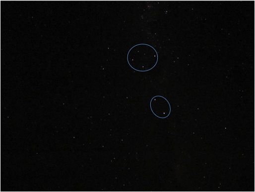
We were up on Mt John on a moonless night and tried to capture the star-filled sky.  You will probably have to click on the following photos to blow them up.  The first shows the Southern Cross and its two pointer stars.


Here is the Orion constellation above the observatory's cafe/gift shop.  If you know the constellations you will notice that Orion is upside down with his sword pointing up!  This is the southern hemisphere for sure.


I mentioned previously the importance of sheep dogs to the development of this country.  Here is another memorial right by the lakeside in the village of Lake Tekapo.


And here is another iconic sight: Paula at the computer arranging our future accommodations.  This is possibly the first vacation we have taken where we haven't planned everything out exhaustively ahead of time and secured all reservations weeks in advance.  Paula has been setting it up day by day as we go along - usually 2-7 days in advance.  I rather prefer travelling this way.  We haven't yet set off on a day's drive with no accommodation reserved, trusting that we would be able to find something when we get there.   Maybe we'll try that next.  Up until now we've been travelling in the high season, since it's been summertime down here.  But we're now in late March, past the equinox, which is equivalent to September in the northern hemisphere - - early autumn.  The kids are back in school, and the tourist attractions are perhaps a bit less crowded, although this does appear to be prime time for foreign tourists, particularly Japanese.


Sunday, March 21, 2010

Otago, Southland, and Dunedin

Friday, 26 Feb - Friday, 5 March:  Queenstown to Invercargill to Dunedin

Our last morning in Queenstown we visited the Botanic Gardens down by the lake.  As we looked up toward the mountain where the gondola lift and restaurant are, we saw paragliders, whose take-off point seems to be even higher up the same mountain.  Experienced paragliders can, of course, take off on their own, but the big thing for tourists is the tandem glide.  The tourist (usually small and young) straps in with an experienced pilot, and they go down together.  From this photo I can't tell which it is, but it was a good ride - long time in the air.


From Queenstown we drove southeast into the broad dry plain called Southland.  The town of Cromwell on Lake Dunstan was on the way.  Here is a nice overlook.


A prominent feature at the overlook is this big rock with the International Rotary symbol on it.  I think the overlook was a Rotary project.


Invercargill is the southernmost real city in New Zealand.  Earlier in the trip when we had mentioned that we intended to visit Invercargill, people had said we shouldn't bother - there's nothing in Invercargill.  Well, they were wrong.  It's a very nice town with a lovely garden/zoo/aviary which we really enjoyed.  The topography reminds me of the Gulf Coast in the US - - spacious, flat, and low altitude.  But, of course, being south in the Southern Hemisphere means that it is closest to the South Pole, so, although the weather can be humid in summer, it's not oppressively hot and humid like the Gulf Coast.  It's an interesting example of a temperate mid-latitude coastal plain at latitude 46.4 degrees south.

This is a alpaca, a native of South America that is increasingly popular in New Zealand for its wool.


Here is a buck deer that would excite any of my deer hunting friends.  Deer were introduced back in the 19th century and quickly got out of hand.  Subsequently for many years there were extensive government eradication programs during which the wild deer were rounded up when possible, shot from helicopters when capturing them was impractical.  They are now raised in high-fenced farms for the venison market.  I believe that it is always open season on deer in the wild in New Zealand.  Personal opinion: I wish Michigan would do something to greatly reduce the size of its wild deer population. I know that deer hunting brings in lots of revenue to Michigan from hunters all over the midwest, but the deer are also very destructive and are involved in something like 60,000 deer-car collisions every year - - all of them expensive, some of them causing injury or death to humans.  Death to Bambi ! ! !


Here is Paula among the roses in the Invercargill Botanic Garden.


The aviary was spectacular!  The variety of colorful native southern hemisphere birds was just amazing.

The bird I like best in the following photo is the one with the white top and blue back.


We stayed just one night in Invercargill, and then drove around the southeast coast to Dunedin.  Along the way we took a detour south to Curio Bay, which, at latitude 46.661 deg S is within a couple of kilometers of the farthest south point on the South Island.  Out in the sand are the remnants of a petrified forest.  It's not as obvious and easy to recognize as a couple of petrified forests in the US, but there are good explanatory signs overlooking the bay to help the visitor recognize it.


On to Dunedin and its Botanic Gardens.  They have a great rock garden built up on terraces on the hillside, which Paula really enjoyed.


There was a cute statue of Peter Pan in the garden - I'm not sure why.  The sign at the base of the statue says, 
"Dedicated to the children of today, tomorrow & the future
Peter Pan           1966
Wendy Group     1968
Gifts of gratitude from Harold Richmond"


The high point of our seven-day stay in Dunedin was riding the choo-choo train.  The Otago Central Railroad was enormously important in opening up the vast fertile lands of Central Otago inland to the northwest of Dunedin.  Eventually in the mid-twentieth century the road system was sufficiently developed that the railroad was no longer cost-effective for freight, but the City Council of Dunedin recognized its potential as a tourist attraction and kept parts of it alive.  There are two scenic passenger routes that run regularly:  the Pacific Coast trip northeast up the coast to Palmerston,  and the Taieri Gorge Scenic Railway up the Taieri river valley to the northwest to Middlemarch.  We took them both on successive days.  Here is a typical view of pacific coast New Zealand:


The space between coaches was open, as was the rear observation deck behind the last car, and I took advantage of both.  What fun looking backwards and videotaping our entry into the many tunnels along the way!

The Taieri Gorge trip was the most spectacular ride we had on our whole tour of New Zealand.  Here is a train trestle over the river:


Several places we have visited have had memorials of one kind or another to the sheepdogs whose expertise and labor were really indespensible to the operation of the many large sheep stations and contributed immensely to the economy.  Wool and sheep meat are still very important export commodities for New Zealand.


More views of the train:


The city of Dunedin is nestled at the root of the Otago Harbor, which is protected on the southwest by the long Otago Peninsula highlands.  Out on that highland a rich banker named Larnach built New Zealand's only castle in the late nineteenth century.  After he died, Larnach's Castle and its extensive grounds were sold and resold, abandoned a couple of times, and fell into decay.  In the mid-1960's an enthusiastic young couple (who apparently had access to some serious money) bought the place as a historical treasure, and they and their family have spent a lifetime restoring it and the gardens on the grounds.  It is open to the public as a commercial enterprise, complete with restaurant and gift shop, and it is well worth a visit.  


We were able to climb up into the tower and take some spectacular pictures all around.  The rooms were outfitted with historically authentic items, many of them recovered at auction and from antique dealers from among the original furnishings of the castle.


Finally, way out at the tip of the Otago Peninsula on Taiaroa Head is the Royal Albatross Center.  Magnificent birds - 10-foot wingspan.  When I first saw pictures of them, I thought they were just overgrown seagulls.  But no, they are in a different family and even a different order from seagulls - - more closely related to petrels and other true seabirds.  I was glad to learn that, because I hate seagulls!


Friday, March 19, 2010

Queenstown, Glenorchy, & Isengard

Tue - Thur, 23-25 Feb: Queenstown
On our way from Manapouri to Queenstown we went partway up the road to Milford Sound just to see what we could see.  We had already been to Milford Sound itself twice (once by sea, once by air), but we wanted to try the road, since it is the only paved road access to any fiord in all of Fiordland National Park.  Once again: it's called Milford Sound, but it's actually Milford fiord.  To call it a fiord is sound; to call it a sound is unsound.  I wonder if they have a Fiord Fiesta here?

Here is a view from the Kaka Creek Lookout at the pass summit, near the trailhead of the popular (but demanding) Routeburn track.


Now look at a good detailed map of New Zealand.  This point on Milford Road is less than 20 km west from the end of the road that leads up the Dart River from Glenorchy, which is just up the lake along a good paved road from Queensland.  And yet the Routeburn track is the only path connecting the two points - not so much as even a jeep trail.  To get from here to the other side, and thus access to Queenstown, drivers have to go almost 300 km: down to Te Anau, over to Lumsden, and back up to Queenstown.  Given the amount of tourist traffic that eventually visits both Milford Sound and Queenstown, you'd think they would build a road to connect them directly, but no, that would violate the wilderness and make it too easy for the tourists!  So drive we did, for hours and hours.

Perhaps this would be a good place to insert photos showing characteristic poses of both Tyler and Paula.


One of the days in Queenstown we drove up to the Coronet Peak Ski Lodge which overlooks the whole valley.


Another day we took a 4WD outback tour with a local guide.  We drove by the gorge where bungee (bungy, bunjee) jumping began with A. J. Hackett right outside Queenstown.  His operation is still in operation:


Then we went up to Glenorchy and up the Dart River to visit both Paradise and Kinloch, both of which are mere fictions on the map at the end of a long dirt road.  But they are significant because this area was used as a location for Isengard in the Lord of the Rings movie.  Here is Mt. Earnslaw from the head of Lake Wakatipu near Glenorchy.


Here is the view across the broad Dart riverbed.  Compare it to the photo from the movie - match up the peaks in the background.  Isengard was added by digital magic, and the river removed.


This really is a lovely river valley, and of course we were there in late summer - equivalent to late August in the Northern Hemisphere.  Here are some friendly natives that we met.  These are for Rachel.


About Us

My photo
Midland, Michigan, United States
Tyler is a retired research scientist (PhD Chemistry, University of Illinois) who worked for The Dow Chemical Company. The last 16 years of his career he served as grants and contracts manager for Dow's External Technology program, involving Dow sponsored research grants to universities, government research contracts into Dow, and a variety of other industry/university/government research partnerships. Paula is a botanist with graduate work in plant taxonomy. She worked as a microbiology research assistant for four years while Tyler was in graduate school, then led a busy life raising 3 kids, gardening, and serving in a variety of church ministries and activities.